The Land
2.325 hectares in Europe's last wild coast — a living laboratory for renaturation, permaculture, and sustainable building within the Natura 2000 network.
Key Facts
Project Zones
Five integrated zones designed using permaculture principles — from food forest to pollinator meadow.
History & Context
Ancient Agricultural Use
For centuries this land was used for traditional dryland farming — cereals, olives, carob, and almonds. The stone walls and terraces visible today are remnants of generations of careful land stewardship.
50 Years of Abandonment
Like much of rural Algarve, the land was abandoned as agriculture declined. Natural succession has begun — cistus, lavender, and native grasses are returning, but without management, fire risk increases.
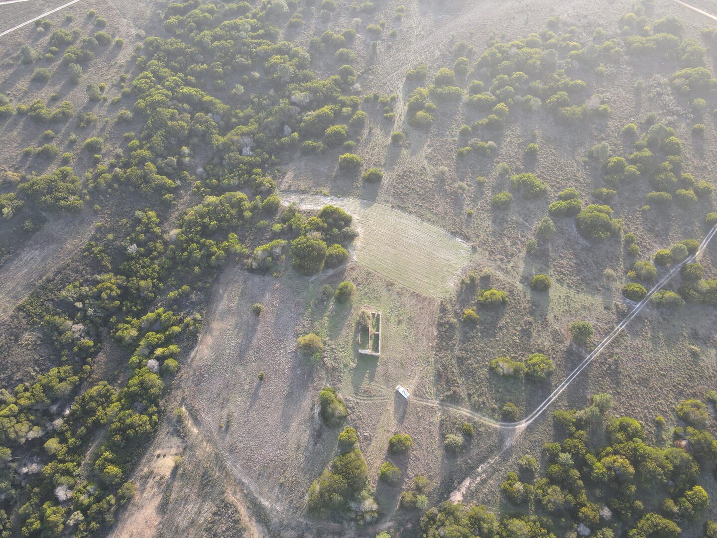
Pre-1951 Ruin
The existing agricultural ruin predates 1951, proven by historical aerial photography. At 4.12m documented height, it establishes a legal precedent for rebuilding — the foundation of our permit strategy.
Protected Landscape
Part of the PNSACV (since 1988) and Natura 2000 network. Managed under ICNF guidelines. Any intervention must enhance, not diminish, the ecological value of this protected area.
Why This Land Matters
The Costa Vicentina is the last remaining undeveloped coastline in Southern Europe. What happens here sets a precedent.
+1.5°C warming since 1970. Rainfall declining. Without intervention, this landscape faces irreversible degradation.
Only 2.8% organic matter in soil — well below the 4% threshold for resilient ecosystems. Building soil is our first priority.
If renaturation works on 2.325 ha, it can work on 23,250 m². Every measurement we take adds to the evidence base.
Explore the Land
Flora & Fauna
Discover the species that call this land home — from endemic orchids to Bonelli's eagles.
Geology & Soils
Limestone karst, terra rossa, and 200 million years of geological heritage beneath our feet.
Climate & Water
Mediterranean sun, Atlantic wind, and the water challenge that defines life on Europe's edge.